Property developers, real estate owners, cultural heritage sites, landowners, planners, and destination marketers who need a real place captured as an immersive browser-viewable and experiential scene.
What it earns the buyer
Turn drone capture into a navigable spatial scene instead of a flat video or photo set.
Combine traditional 3D-mesh material with 3DGS to show the unbuilt / future / past.
Make landscapes, islands, routes, and sites understandable remotely before a visit or decision.
Create a reusable spatial asset for online tours, stakeholder communication, and future AR or 3D layers.
What you get
Drone capture planning for Gaussian splatting and spatial reconstruction
Optimized online splat viewer or embed-ready experience
Optional labels, guided viewpoints, route notes
Raw capture dataset and raw 3DGS files if required
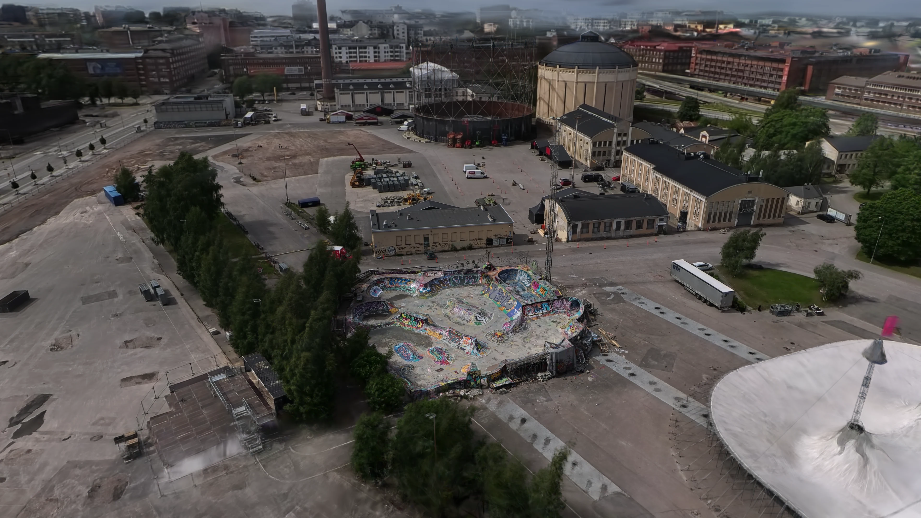
Suvilahti DIY · Project ETERNAL
A drone-aided Gaussian splat of Suvilahti DIY in Helsinki, captured as a lightweight browser scene that can be explored from a normal link or embed.
You do not need a finished technical brief. A location, access context, and a rough idea of the viewing goal are enough for the first call; we can help define flight planning, permissions, and whether Gaussian splatting is the right format.
These three examples show the format across a skatepark, a future-facing cultural site, and a free seaside campsite: real places captured for interactive online viewing.
Same six steps, adapted to each project's requirements. The first call decides where to enter and what to skip.
01
Plan the capture
We define the area, viewing goals, drone route, safety constraints, permissions, and the level of detail the final splat needs.
02
Fly and collect
Drone capture is planned for coverage, overlap, lighting, weather, and the future viewer path rather than only for a pretty video.
03
Process the splat
The captured material is processed into a Gaussian splat, then gets cleaned and optimized for online viewing.
04
Build the interactive experience
We define starting views, guided camera points, labels, route notes, and any supporting visual materials.
05
Embed the scene
The scene is prepared for an iframe or web embed, like the island demo shown on this page.
06
Extend with context
The splat can be paired with images, graphics and/or traditional 3D assets depending on the project requirements.
FAQ
The questions buyers actually ask. Open one to read.
Q01What is Gaussian splatting good for?+
It is useful for capturing real places as immersive scenes at near photographic accuracy.
Q02Do you handle drone capture?+
We can plan drone-enabled capture and coordinate what is needed for the scene, including access, safety, permissions, weather, and shot coverage.
Q03Can this be embedded on a website?+
Yes. The intended delivery is an online viewer or iframe-style embed, like the island demo on this page.
Q04Is this the same as a 3D model?+
No. A Gaussian splat is closer to a point cloud rather than a 3D-mesh or CAD-file. It can feel more real, but it is edited and used differently from modeled 3D.
Q05Can labels or informational hotspots be added?+
Yes. Guided views, labels, images, map context, and supporting text can be added around the captured scene.
Q06WTF is a Gaussian splat and why is it called that??!+
A 3D Gaussian splat is a way to reconstruct a scene from images by representing it as many soft, semi-transparent 3D blobs called Gaussians. They are called splats because each blob is projected, or splatted, onto the screen to build the final view. More: https://en.wikipedia.org/wiki/Gaussian_splatting
AppsFlyer's 2025 benchmark across 28 billion installs puts Day-1 retention at around 25%. AR apps sit below that floor, because every reviewer is a single-use case, not a habit. WebAR removes the funnel. The link that opened the experience the first time still opens it the second.
Rework runs around 12% of a typical construction budget. Peer-reviewed BIM studies in 2025 report that putting an optimised 3D model in front of stakeholders before the first pour prevents at least a third of that, and as much as half on projects that share the model early. One Asian rail case caught 3,000 design clashes and shaved 12% off construction cost on its own.
Shopify's own data, drawn from millions of stores. The 65% sits next to a 94% conversion lift on stores that add any 3D content, and a 40% drop in returns when AR closes the imagination gap. The mechanism carries from product pages to construction, museums, and brand work.