Planning events with an interactive 3D venue map
How we used a scan of Heureka to explore fictional festival layouts, guided tours and day-to-night views.
Read article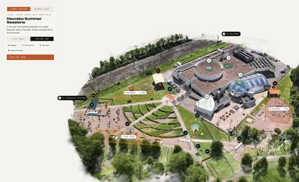

Aerial Gaussian splat as a venue blueprint and public event map
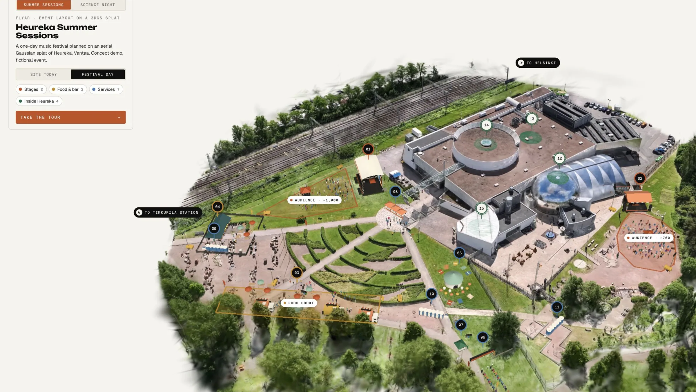
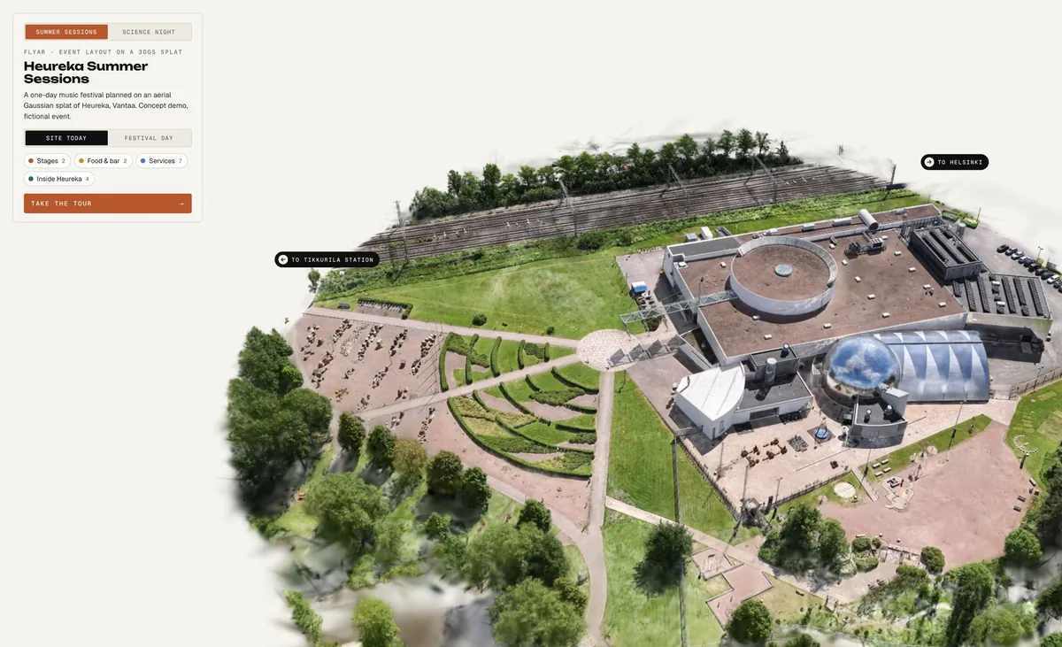
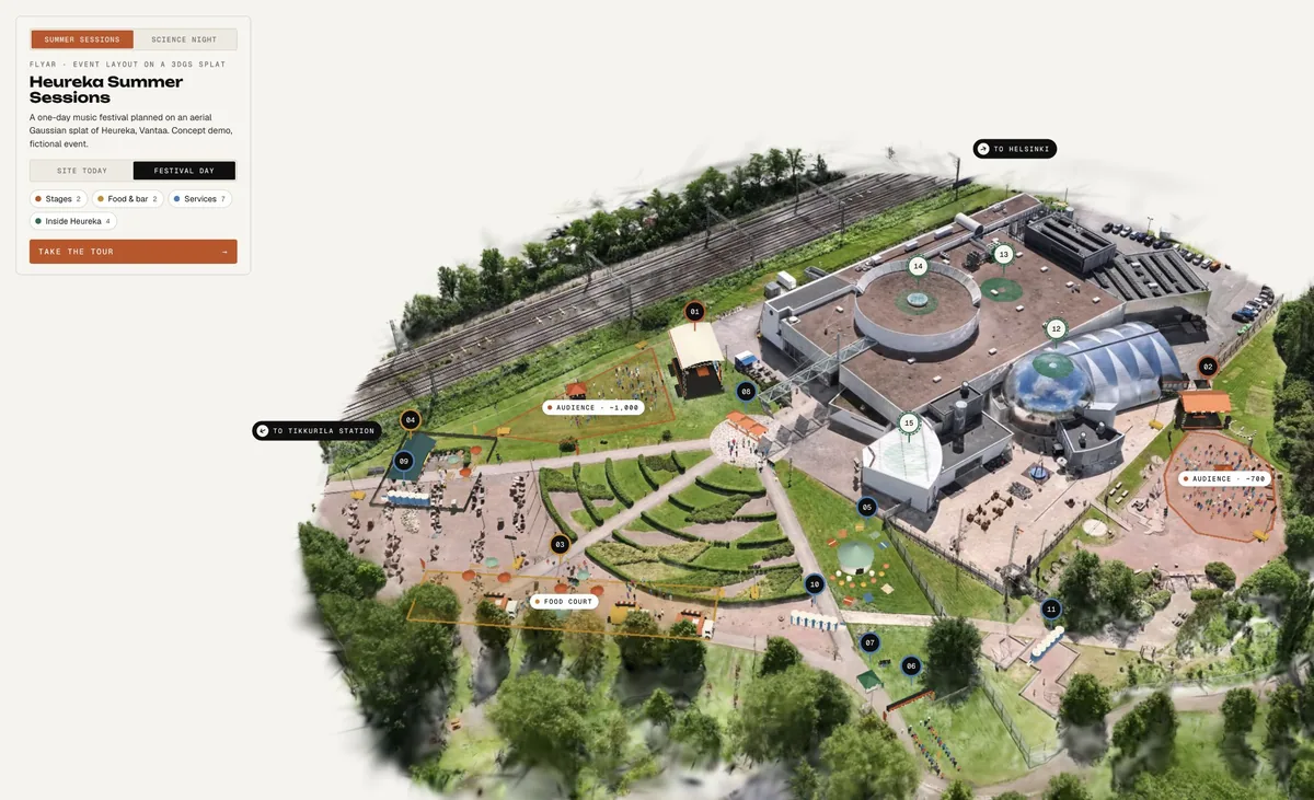
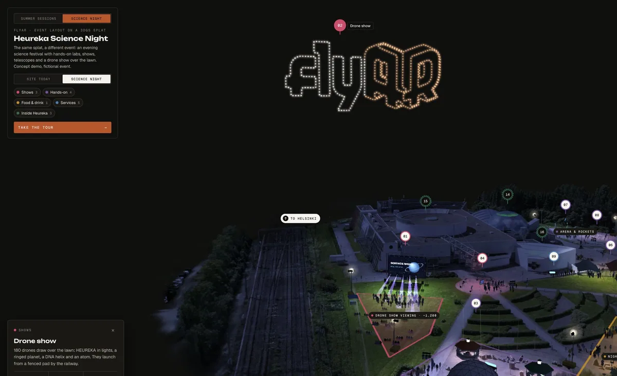
A drone scan of Heureka, the Finnish Science Centre in Vantaa, turned into one interactive 3D scene. The venue can show and explain the whole site. Event organisers can plan stages, food, services and crowds on the real ground, then publish the same scene as the public event map.
A flyAR concept demo, not commissioned by Heureka. Both events are fictional and capacities are illustrative.
Heureka venue & event map (demo) · interactive 3D · approximately 28 MB of scene assets when opened
01 Problem
Venues explain their site with PDF maps, photos and site visits. None shows real distances, slopes or what actually fits. Organisers plan on 2D drawings and walk the site again and again. Visitors get a static map that does not answer simple questions: where is the stage, where do I eat, how do I get here.
02 Approach
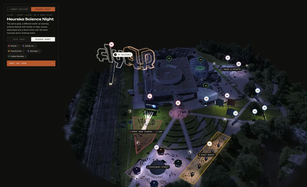
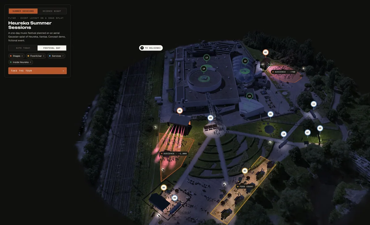
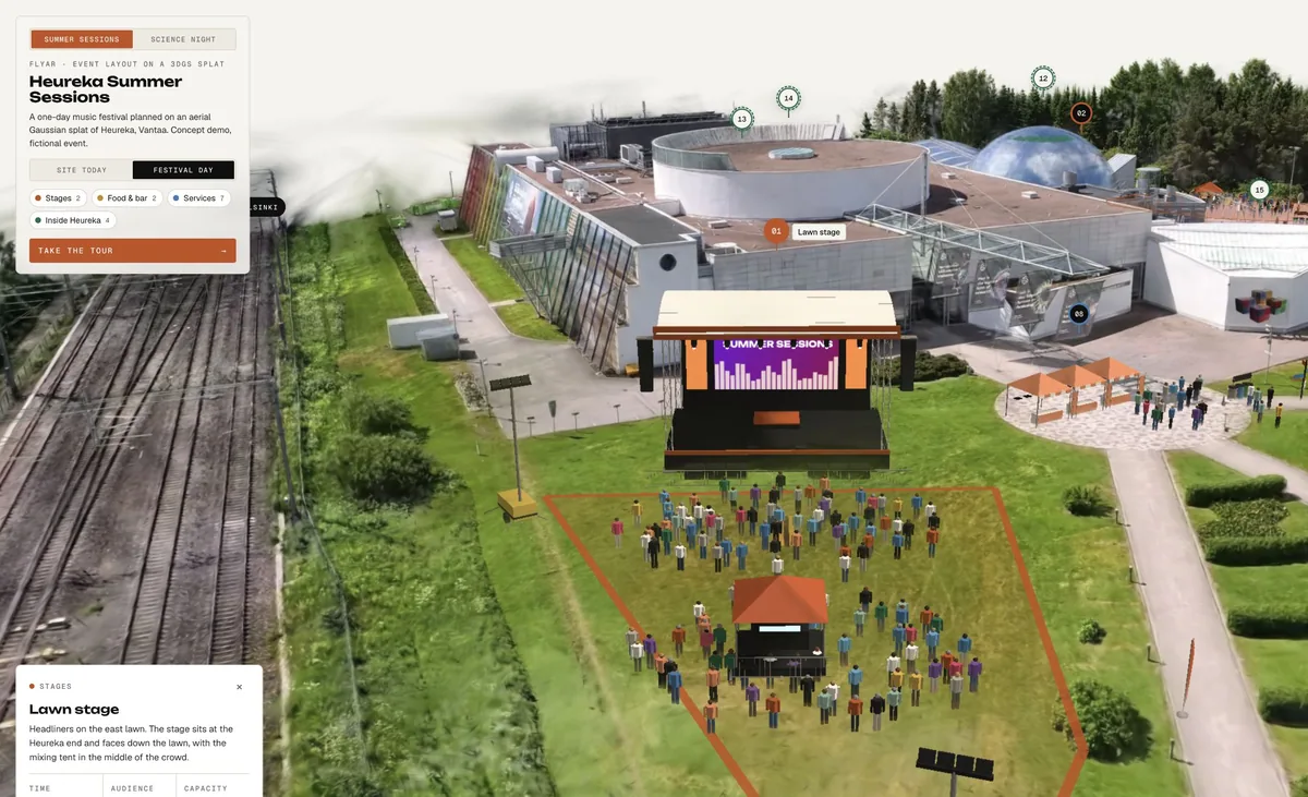
We flew the site with a 360 drone camera, extracted reconstruction images and trained an aerial Gaussian splat. The result is a photo-real 3D scan in true scale, ground heights included. On the scan we built two concept event layouts. Summer Sessions is a one-day music festival with two stages, a food court, a bar and services. Science Night is an evening expo with a screen stage, experiment street, a night market and a drone show. Simple true-scale blocks represent stages, tents, toilets, fences and crowds. Pins and zones answer visitor questions. A guided tour, evening lighting and passing trains show the place in context. It runs in the browser, so one link works for the venue, organisers, suppliers and visitors.
03 Outcome
04 Try it
Service used
Capture a destination as a photo-derived 3D scene that visitors can explore from a normal browser link.
How we used a scan of Heureka to explore fictional festival layouts, guided tours and day-to-night views.
Read article