
Aerial capture
What we've learned from drone Gaussian splatting
Lesson one: land before the battery says so
On one of my first capture flights, I nearly landed the drone in a lake. The battery was getting low, I was still "just getting one more pass", and the shore suddenly looked very far away. Lesson learned: when the battery starts dropping, head home.
The rest of the process has been much kinder. A single flight with a 360 drone, an ordinary laptop and some open-source software can turn a real place into a photorealistic 3D scene that anyone can explore from a link. No render farm, no app, no 3D modelling.
This post covers what that technique, drone-shot Gaussian splatting, is good for, what it takes, and where it stops being the right tool.
What drone Gaussian splatting is
Drone Gaussian splatting is a way to turn aerial video of a real place into an interactive, photorealistic 3D scene. The software works out where the camera was for every frame, then builds the scene from millions of small, soft, coloured blobs called Gaussian splats. Seen together, they look like a photograph you can fly through.
Compared with older 3D scanning, splats are especially good at the things that usually break: trees, grass, water edges, thin railings and reflective glass. And they run in real time in an ordinary web browser, on phones too, if the scene is optimized for it.
It has moved from research paper to mainstream quickly:
- Real estate: in July 2025 Zillow launched SkyTour, which uses Gaussian splatting to turn drone footage into an aerial 3D view of a home's exterior. (Zillow)
- Standards: in February 2026 the Khronos Group, the body behind the glTF 3D format, announced a glTF extension for storing Gaussian splats. That means splats are on their way to being a normal, portable 3D format, not a niche file type. (Khronos)
- Hardware: 360 drones like the Antigravity A1 capture every direction at once, so one flight covers what used to take several.
Four places, four different jobs
The nice thing about a splat is that the capture is the same every time, but what you do with it isn't. Here are four places we've flown.
Suvilahti DIY: saving a place before it's gone
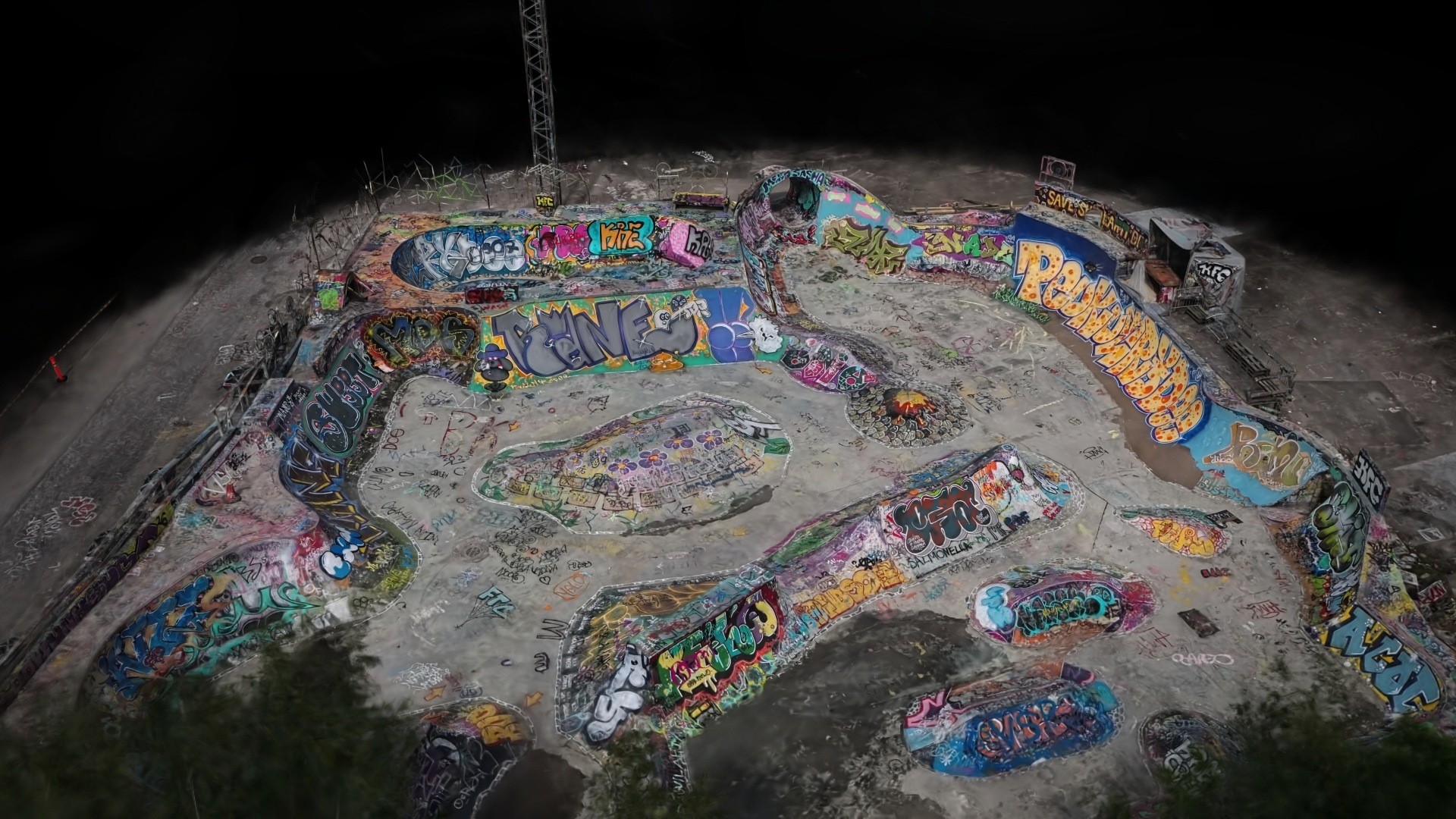
Local skaters started building Suvilahti DIY in Helsinki as a volunteer project in 2011. It grew into a concrete park known well beyond Finland, and demolition was scheduled to start in October 2026. We flew it in June, around, on and above the park, and trained the splat locally on a laptop.
The scan placed third in Project ETERNAL, a global Gaussian splatting challenge run by Antigravity, Insta360 and Splatica. Part of the prize went to another Helsinki skate DIY project, which felt right.
Miekankoski: a museum that's mostly outdoors
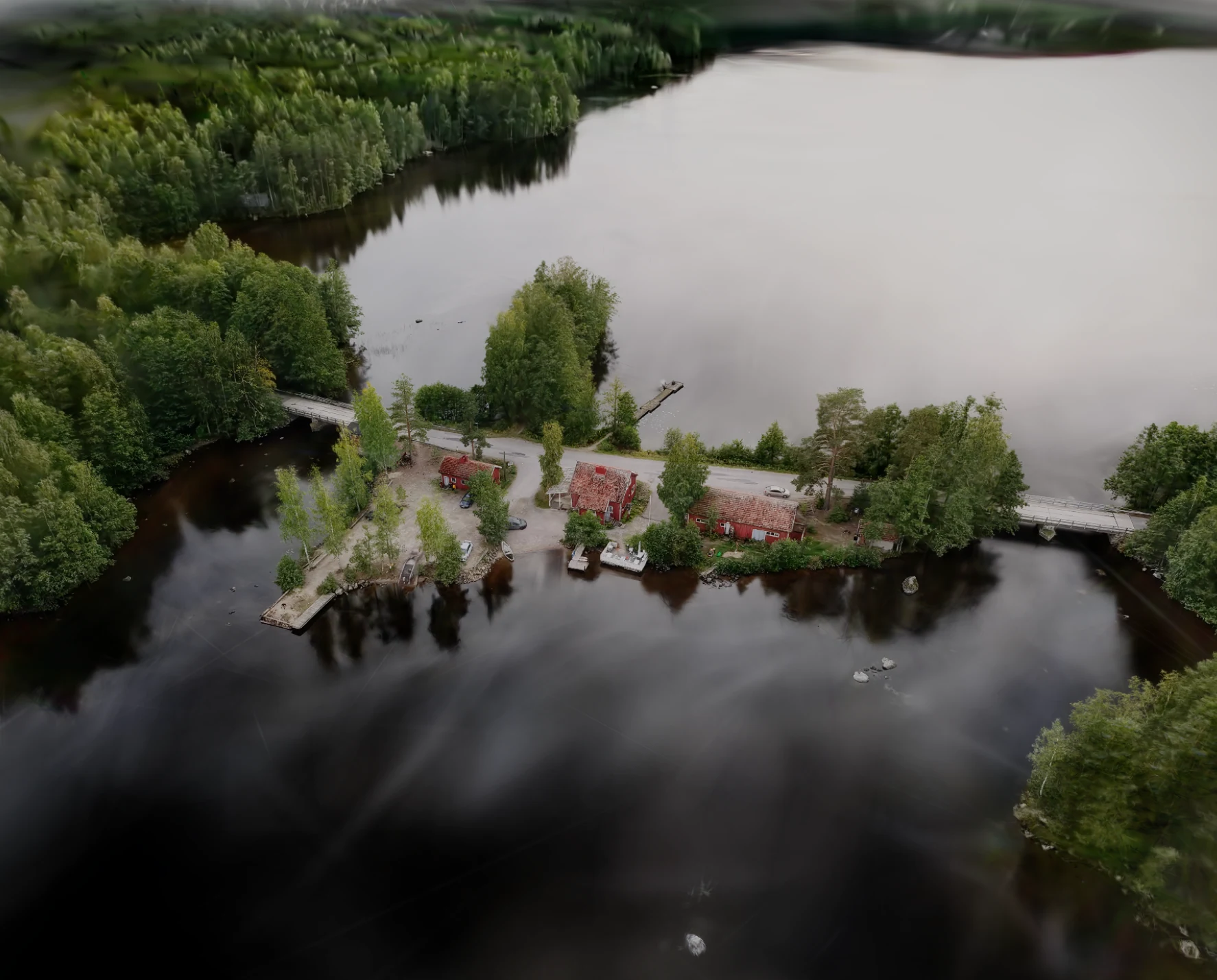
The Museum of Log Floating in Mäntyharju sits on a small island between a lake and rapids. The café, the 1940s log-floating cabin, forge and warehouse, the bridge and the waterways are all part of the story. That's hard to fit in a photo, but it works naturally as one connected 3D scene, with markers that open information about each building.
Oosaare: "what's it like there?" answered before you go
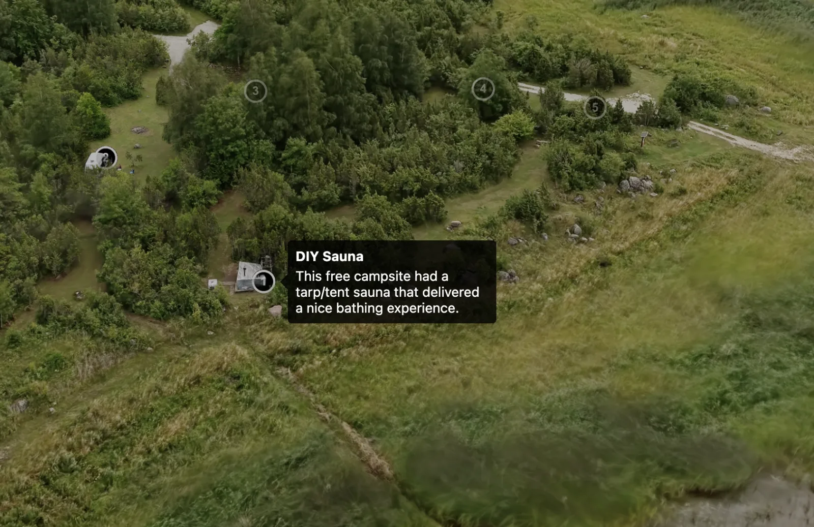
Oosaare Telkimisplats is a free, community-run seaside campsite on Muhu island in Estonia, with a free sauna. The tour lets people check the layout, the access track, the sauna and the shoreline before they arrive. Small site, small budget, very practical.
Heureka: the scan as a planning base
At Heureka in Vantaa, we used the splat as a blueprint and planned two imaginary events on the real ground, with day and evening modes. We wrote about it in detail in our post on interactive 3D maps for venues and festivals.
Explore the Heureka venue & event map
The equipment and software we use
Nothing exotic. Here's the setup behind all four scans:
- Plan the flight. Area, viewpoints that matter, permissions, weather and a safe route.
- Fly with a 360 drone. We use an Antigravity A1. Because it films in every direction at once, one pass catches far more angles than a regular camera drone. Its obstacle sensing also means it won't fly into anything unless you really insist.
- Pull frames from the footage. The 360 video is turned into a set of overlapping still images for reconstruction.
- Find the cameras. COLMAP, an open-source tool, works out where each image was taken from.
- Train the splat. We use Brush, also open source, on an M4 MacBook Air. It's not the most powerful machine around, but it gets there, and nothing has to leave our own computer.
- Clean up. Floating bits and stray splats get removed in SuperSplat. Funnily enough, Claude has also cleaned up some floaters just by being asked.
- Lighten it. Big scans get thinned and compressed for the web. At Heureka, going from 3.53 million to 1.55 million splats cut the file from 53 MB to 24 MB.
- Build the experience. In PlayCanvas we add starting views, a guided tour, labels and hotspots, and anything modeled on top.
- Publish. A link, a website embed and a QR code for use on site.
What we've learned (and where splats stop)
On capture:
- Battery discipline. See the lake story. Plan the route so you're heading back while there's still plenty left.
- Light and weather. Even, bright light and calm wind give the cleanest results. Hard midday shadows and gusty days don't.
- Water, glass and leaves are tricky. Splats handle them better than older methods, but moving water and reflections still produce some fuzz to clean up.
- People and cars move. An empty site scans more cleanly than a busy one, so timing matters.
- Permissions first. Landowner OK, local drone rules and any airspace restrictions get sorted before the flight, not on site.
On what a splat is and isn't:
- It's for seeing, not surveying. A splat is photorealistic and in plausible true scale, good enough to plan an event layout on. But it isn't a land survey. For engineering-grade measurements you still want a surveyor, LiDAR or photogrammetry with ground control points.
- It's not a mesh. You can't simply 3D-print it or drop it into a CAD model. For planned changes we model them as mesh on top of the scan.
- Big areas need optimizing. The larger the site, the more work goes into keeping it quick on a phone.
- The edges are ragged. Every scan ends somewhere, usually in a rough circle. Good starting views and a guided tour keep people looking at the good part.
Who it's for, and what a project takes
Drone splats make the most sense when the place itself is the thing you're trying to explain:
| Who | Typical use |
|---|---|
| Destinations and tourism teams | Let visitors explore before they travel; a visual layer for websites and route planning |
| Museums and heritage sites | Show outdoor sites as one connected scene; record places before they change |
| Venues and event organisers | A true-scale base for planning layouts and a public event map |
| Property developers and planners | Show a site and its surroundings, with planned changes modeled on top |
| Landowners and communities | A simple way to show an area to people who can't visit |
What we need to get started: the location, access and permission details, what you want people to see or understand, and where the result will live (your website, a campaign, a QR sign on site). Even a rough idea and a few photos are enough for a first call.
A destination tour typically takes 1 to 4 weeks. Bigger projects with more interaction or modeled content take 3 to 8 weeks. Weather and permissions are usually what set the pace. You get the interactive tour as a link or embed, plus the splat itself as a reusable asset.
FAQ
What is drone Gaussian splatting? A way to turn drone footage of a real place into a photorealistic 3D scene made of millions of small Gaussian "splats". People can explore it interactively in a web browser.
How is it different from photogrammetry? Photogrammetry builds a textured mesh and is the better choice for accurate measurement. Gaussian splatting is usually faster to produce, looks more photographic, and handles trees, water and glass better. It's built for viewing, not surveying.
Do viewers need an app or a powerful computer? No. The scene runs in an ordinary browser on desktop and phone, opened from a link, an embed or a QR code.
How much area can one flight cover? It depends on the site, the detail you need and the drone rules for the area. We plan coverage, overlap and route before each flight.
Can you add information to the scene? Yes: starting views, guided tours, labels, hotspots, images, links, and 3D-modeled objects such as planned buildings or event layouts.
Do we own the scan? You get the interactive tour and, if you need them, the raw capture and splat files to reuse later.
Got a place worth flying?
Send us the location and what you want people to see. We'll look at whether a drone scan makes sense for the site, including access and where we can fly.
Send us a project note or book a 30-minute call. More on our Aerial Gaussian Splatting and Destinations in photorealistic 3D pages.